


UPDATE: The Ikaria 1:30.000 Geopsis digital map for mobiles and tablets has been upgraded to the latest, most complete edition!
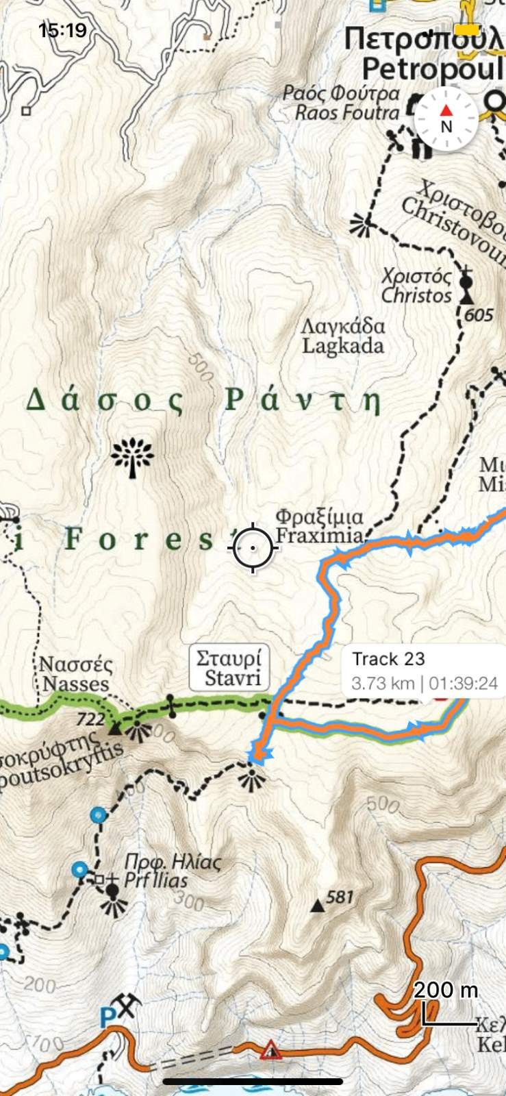
For those wanting to navigate their way around Ikaria's tricky road network, we recommend this Ikaria Map at 1:30.000, which shows your GPS location on the roads and on the footpath networks.
(This is the GPS map showcased near the front of our guidebook)
INSTRUCTIONS FOR DOWNLOADING
1. Find the free app "Avenza Maps" (by Avenza Systems Inc.)
2. Install the app
3. Open the App, find the Map Store
4. Search with the exact keywords 'Ikaria 1:30.000'
5. Buy and install the map (for only $4.99!)
(You can also get it here from the web https://www.avenzamaps.com/maps/918044)
Moreover, everyone who purchased the previous edition gets the upgrade for free. It will appear under the map inside the map as “UPDATE AVAILABLE” in orange colored letters.
You now have a very handy map showing your location while on Ikaria as a dot moving where you go, drive and walk. It shows exactly where you are, so you can find out if you’ve made a wrong turn off a road, hiking trail, etc. You can also:
record GPS tracks and waypoints
plot photos
measure distances etc.


